HAVE ANY QUESTIONS?
We're happy to provide more information.
We're happy to provide more information.

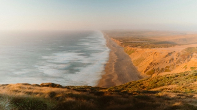
From the bays of Southern Marin to the rugged coastal rivers of Sonoma, these watersheds form the lifeblood of the North Bay. They shape where towns were founded, how agriculture developed, where floods occur, how wildlife moves, and where drinking water comes from. Long before modern boundaries, they defined Indigenous lands, travel routes, and food systems—and today they quietly determine the long-term resilience of our homes and communities.
Every watershed on this page is a working system: supporting people, farms, wildlife, and infrastructure while responding to climate pressure, sea-level rise, and past land-use decisions. Restoration is not about returning to some imagined past—it is about repairing function, so these systems can again support life into the future.
Watersheds are not just environmental features—they are property-defining systems.
Flood risk & drainage are governed by historic floodplains, not parcel lines
Soil Health is enhanced by natural flooding and we should recognize the value
Water supply depends on upstream land management and storage
Fire behavior is influenced by vegetation patterns and watershed moisture
Property values tend to be higher near healthy creeks, wetlands, and protected open space
Insurance costs and permitting increasingly reflect watershed realities
Understanding your watershed means understanding risk, opportunity, and place—the shared root of ecology and economy.
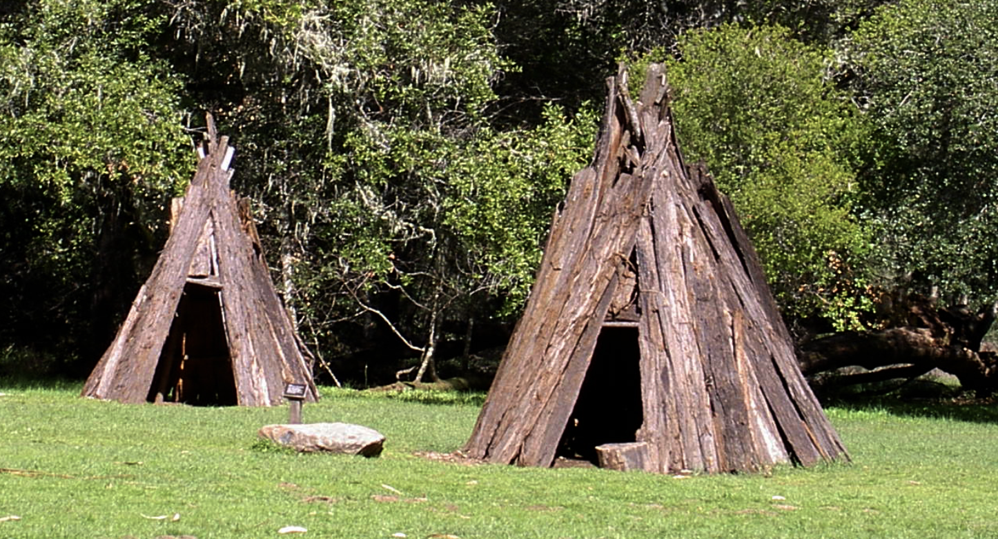
For thousands of years, North Bay watersheds were stewarded by Indigenous peoples—most prominently the Coast Miwok in Marin and southern Sonoma, and the Pomo across Sonoma and Mendocino Counties. Villages were located along creeks, estuaries, and seasonal wetlands—places of abundance, not danger.
Spanish colonization, followed by Mexican ranchos and later American settlement, transformed watersheds through:
Large-scale grazing
Wetland drainage
Logging and milling
Creek channelization
Dam construction
Many areas once dismissed as “worthless swamps” are now understood as essential flood buffers and biodiversity engines, prompting one of the largest regional restoration efforts in California.
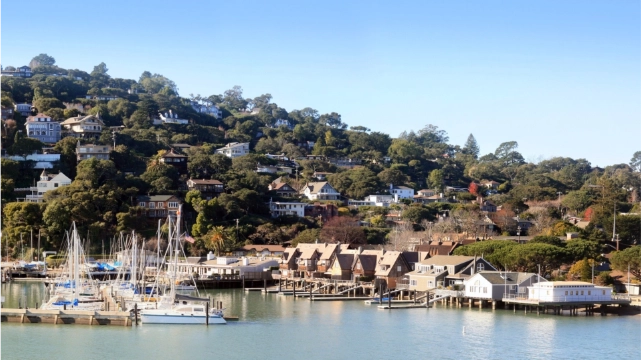
The System
A 21-square-mile, highly urbanized watershed draining Mill Valley, Tiburon, and Belvedere into Richardson Bay—home to some of California’s largest eelgrass beds.
Human Presence & Land Use
~35,000–40,000 residents
Dense housing, marinas, transportation corridors, shoreline parks.
Flora & Ecosystems
Eelgrass meadows
Tidal mudflats
Remnant salt marsh
Oak woodland uplands
Fauna
Harbor seals, bat rays, leopard sharks, herring, shorebirds, herons, egrets.
History & Restoration
Historic dredging and anchoring damaged eelgrass. Restoration now includes anchor-out removal and the Bothin Marsh Living Shoreline, allowing tidal marsh migration as sea levels rise.
The System
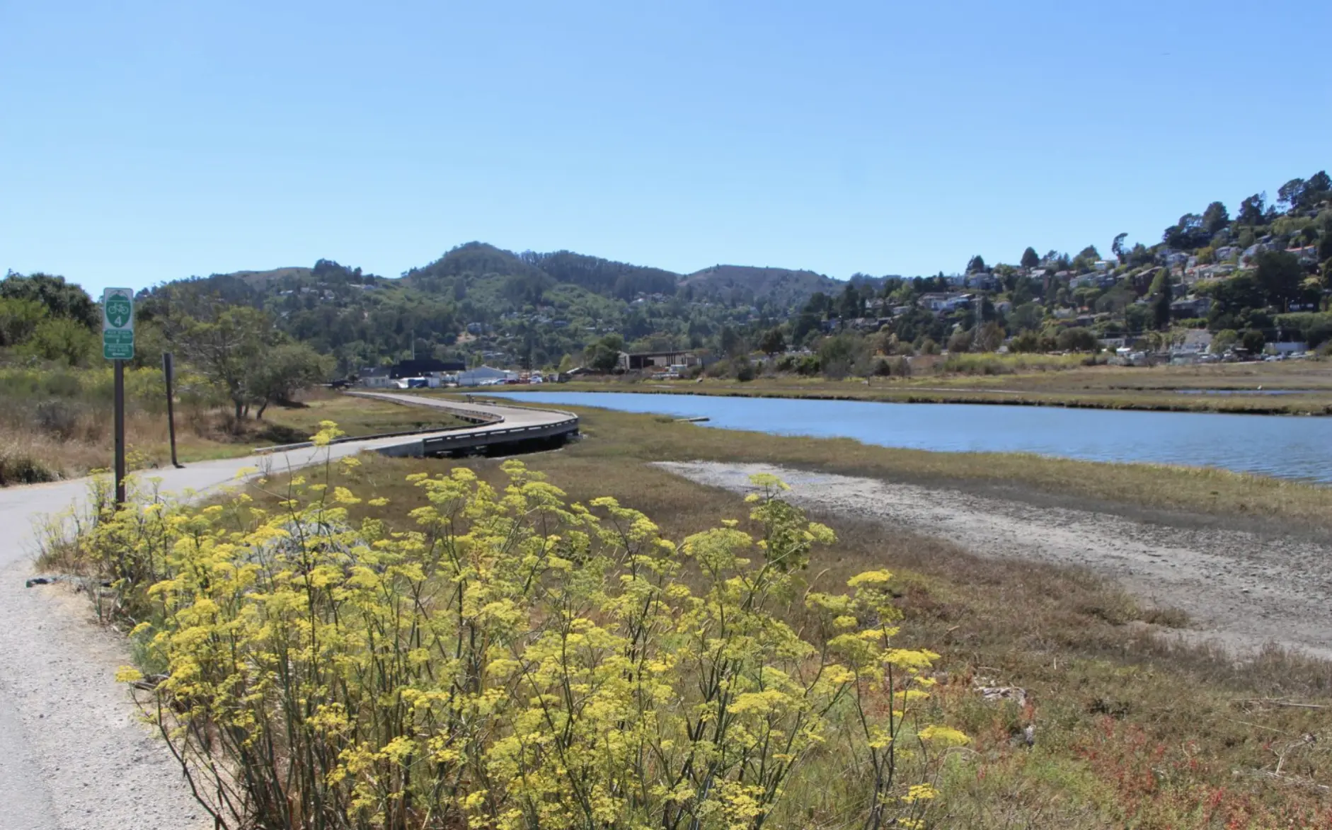
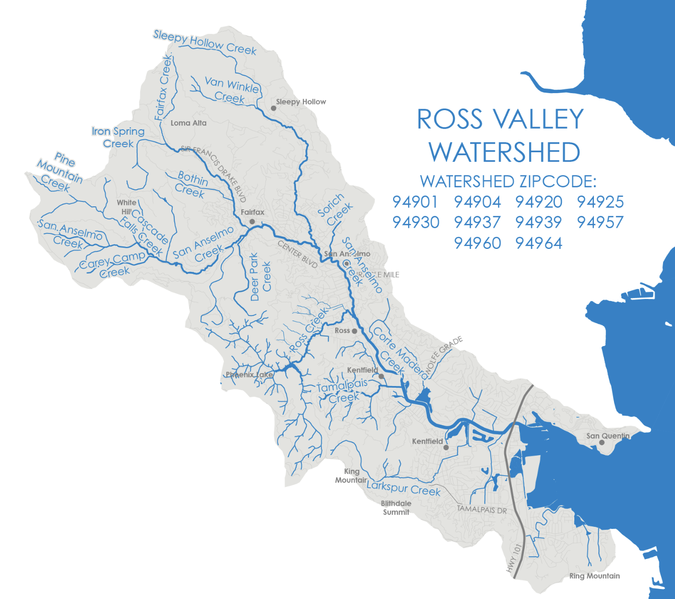
Drains 28 square miles from Mount Tamalpais through Ross and Larkspur.
Human Presence & Land Use
~25,000 residents
Suburban neighborhoods built directly on historic floodplains.
Flora
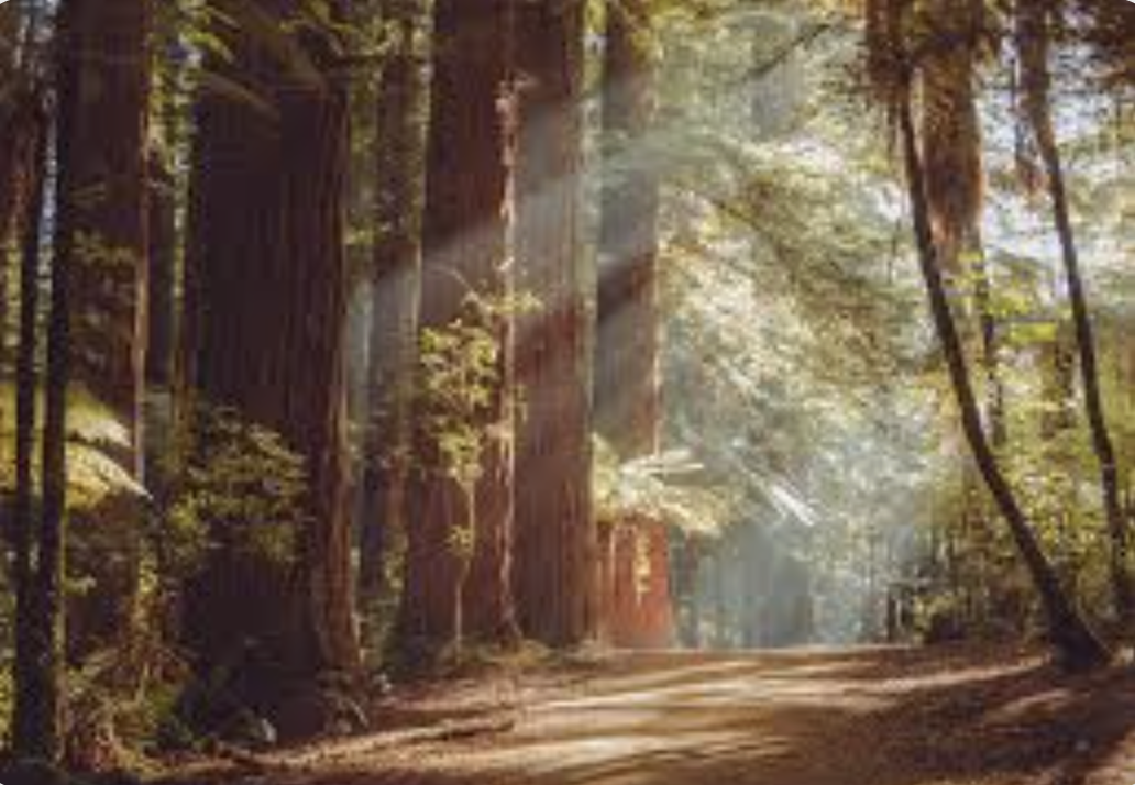
Redwood forest (upper watershed), oak woodland, riparian willow and alder.
Fauna
Steelhead trout, river otters, deer, raccoons, owls, amphibians.
History & Restoration
Decades of flood control hardened the creek. Current projects remove concrete channels, restoring floodplains to reduce flooding and improve fish passage—a shift from control to coexistence.
The System
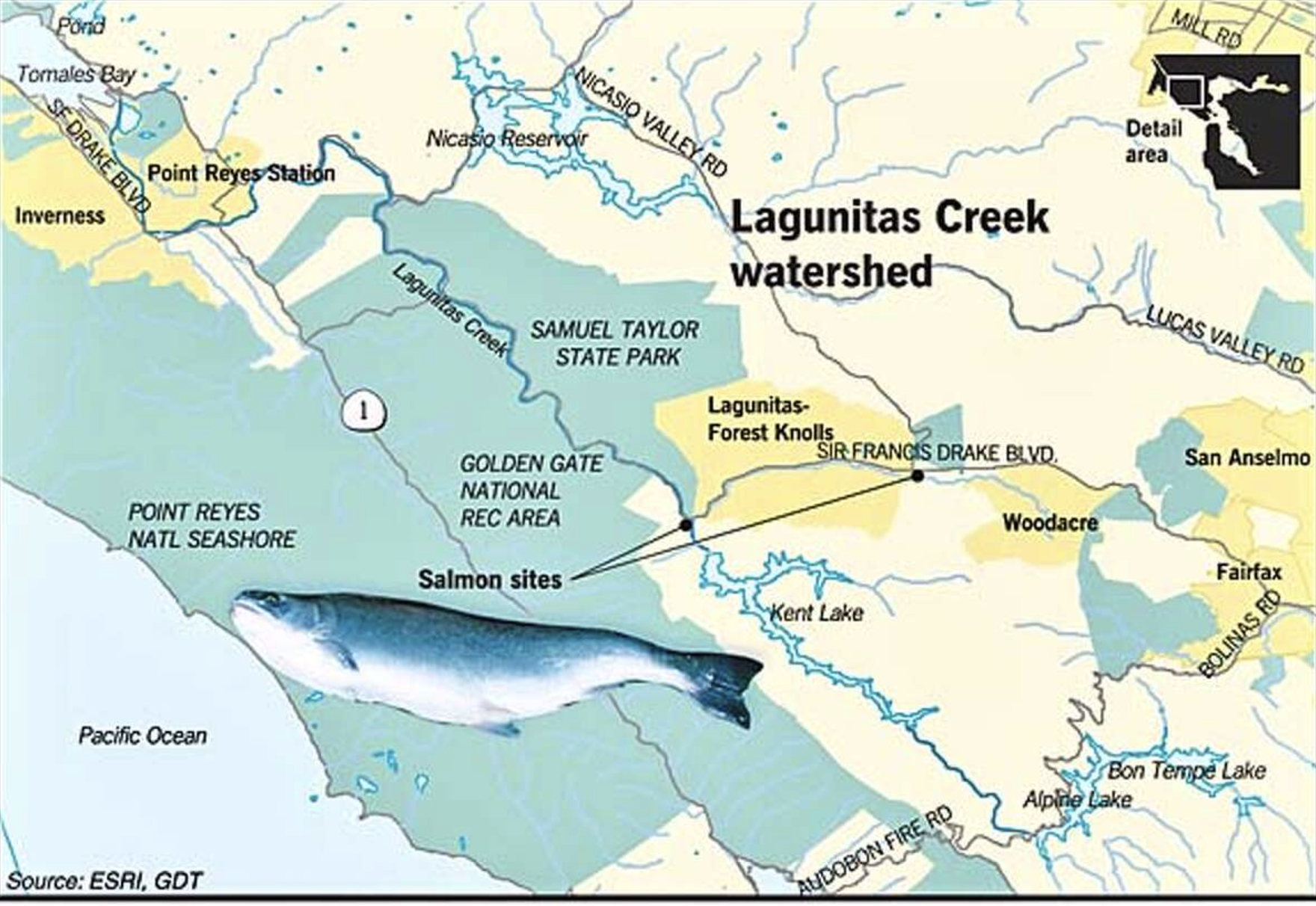
A 103-square-mile watershed and Marin County’s primary municipal water source, with reservoirs on Mt. Tamalpais and Nicasio Valley.
Human Presence
~8,000–10,000 residents
Flora
Coast redwood forest, oak woodland, riparian corridors, tidal marsh.
Fauna
Coho salmon, steelhead, river otters, bobcats, migratory birds.
History & Restoration
Dams built for water supply blocked salmon runs. Decades of work by SPAWN restored habitat, resulting in the southernmost self-sustaining Coho population on the West Coast.
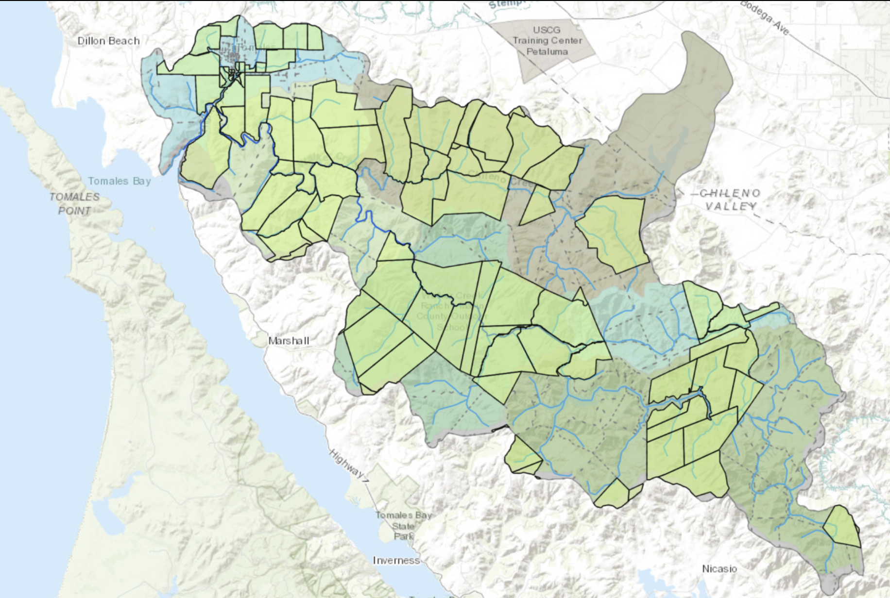
The System
A rural watershed draining into north Tomales Bay.
Human Presence
~1,000–2,000 residents
Flora
Grasslands, coastal scrub, riparian willow and alder.
Fauna
Coho salmon (reintroduced), steelhead, red-legged frogs, raptors.
History & Restoration
Historic grazing simplified channels. Modern restoration focuses on flow complexity and monitoring salmon survival via smolt traps.
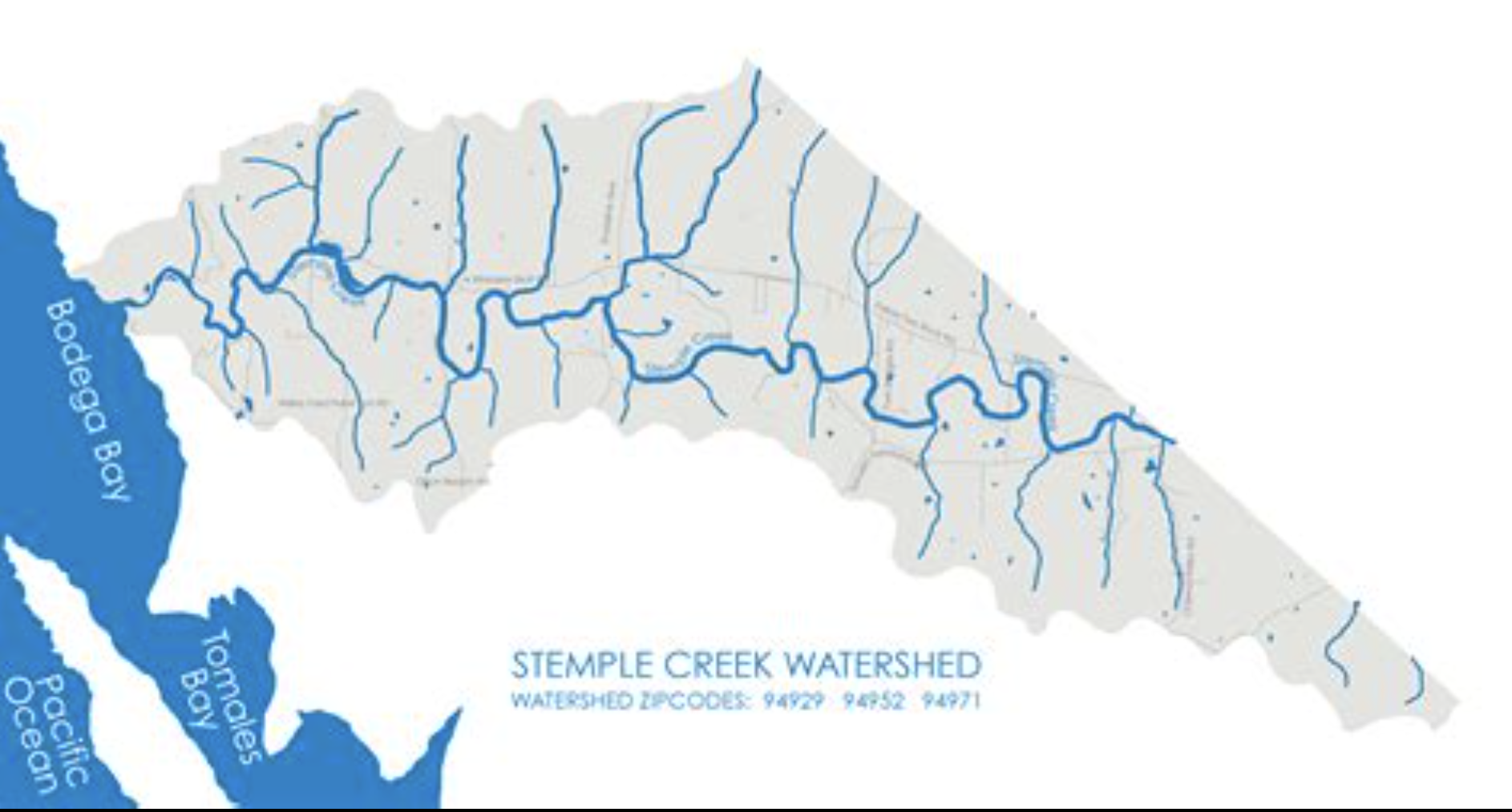
The System
An agricultural watershed draining to the Estero de San Antonio.
Human Presence
~1,500 residents
Flora
Grasslands, riparian oak and willow, estuarine wetlands.
Fauna
California red-legged frog, shorebirds, waterfowl.
History & Restoration
Once degraded by unrestricted grazing, Stemple Creek now showcases carbon farming, riparian fencing, and regenerative ranching as effective habitat restoration tools.
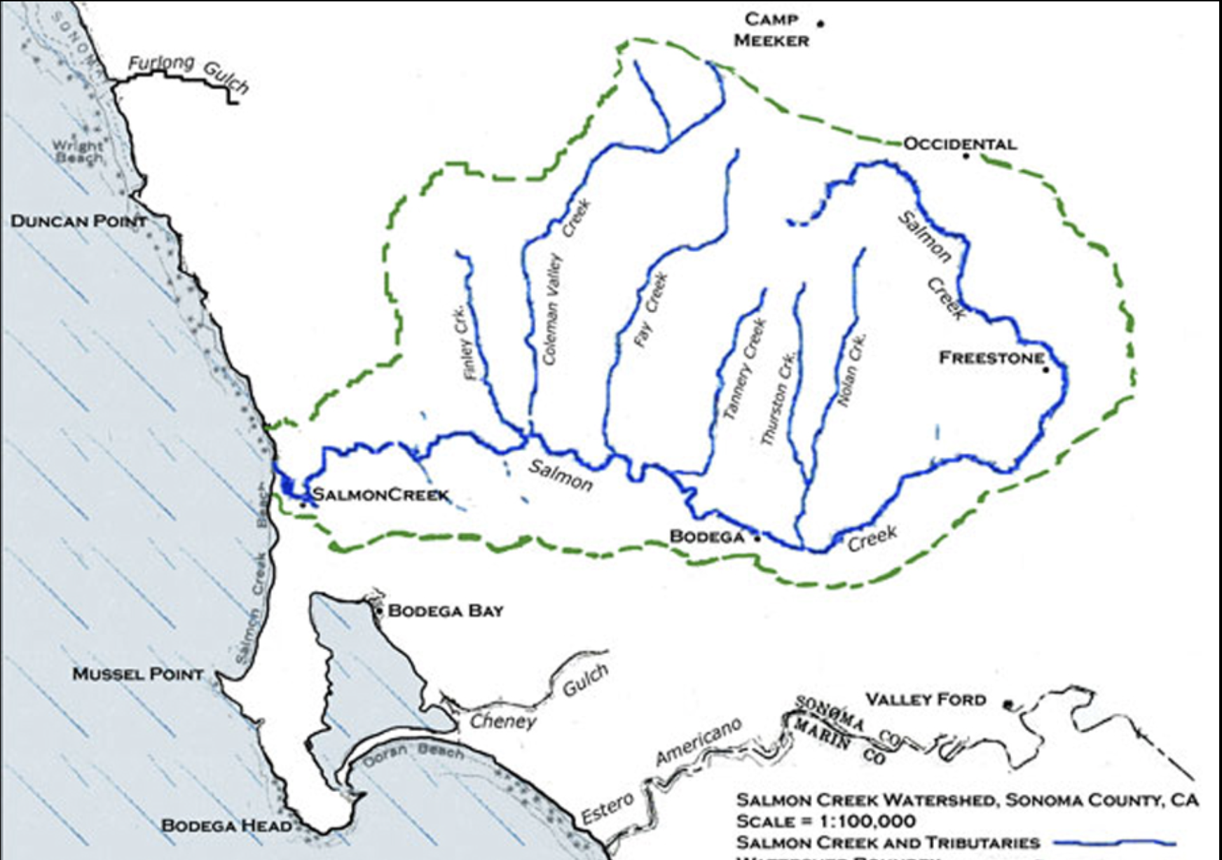
The System
A 35-square-mile coastal basin meeting the Pacific at Bodega Dunes, linking Occidental, Freestone, Bodega, and Bodega Bay.
Human Presence
~3,000–5,000 residents
Flora
Redwood forest, oak woodland, native grasslands, coastal prairie.
Fauna
Steelhead trout, mountain lions, deer, bobcats, river otters, migratory birds.
History & Restoration
Unlike dammed systems, Salmon Creek suffers from summer dewatering. Restoration emphasizes water storage over pumping, protecting steelhead flows.
The System
Watersheds draining Marin’s most populous areas.
Human Presence
80,000+ residents
Flora
Tidal marsh, riparian forest, oak woodland.
Fauna
Steelhead trout, Ridgway’s rail, shorebirds.
History & Restoration
Wetlands were diked and filled. The McInnis Marsh Restoration reopens tidal flow, protecting both wildlife and wastewater infrastructure.
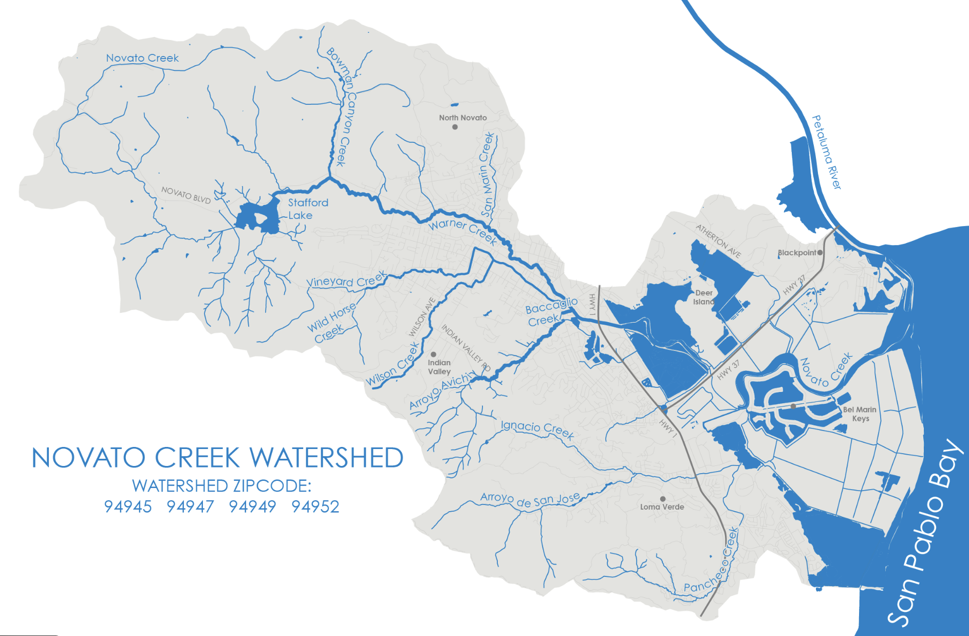
The System
Eastern Marin’s largest watershed (45 square miles).
Human Presence
~60,000 residents
Flora
Freshwater marsh, tidal wetlands, grasslands.
Fauna
Waterfowl, steelhead, amphibians.
History & Restoration
Dredging once removed sediment entirely; today it is reused to build ecotone levees, blending flood protection and habitat.
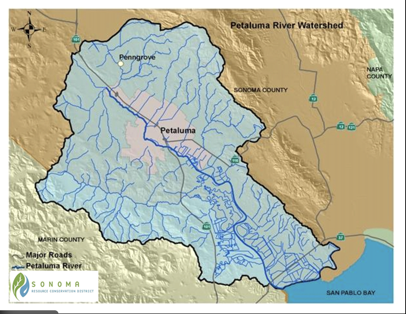
The System
A 146-square-mile tidal river system.
Human Presence
~90,000 residents
Flora
Salt marsh, riparian woodland, grasslands.
Fauna
Salmonids, river otters, raptors, migratory birds.
History & Restoration
Before the Golden Gate Bridge, Petaluma was a shipping hub for lumber, eggs, butter, and milk bound for San Francisco. Modern restoration reconnects floodplains upstream.
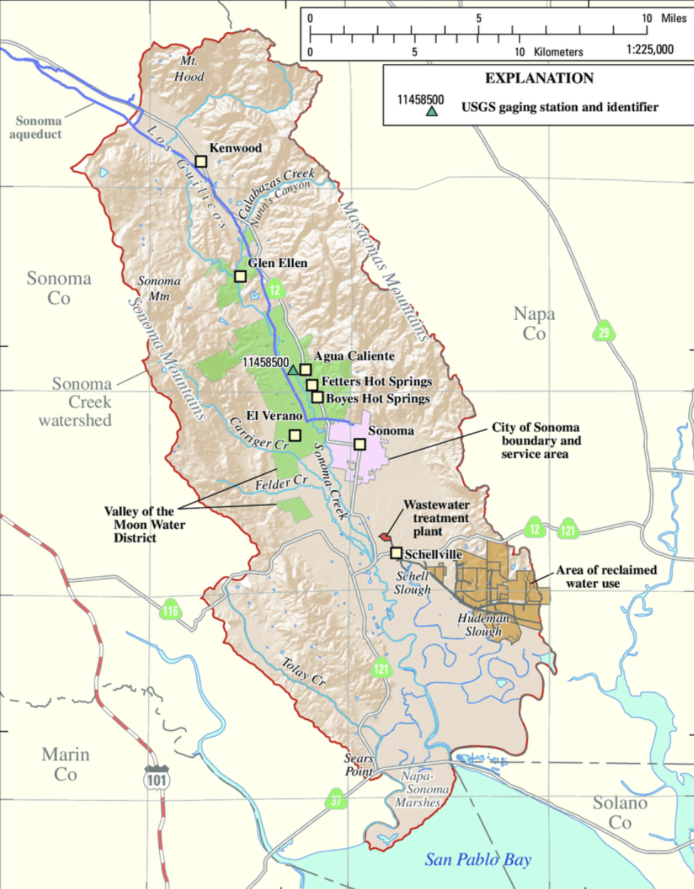
The System
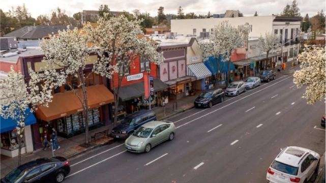
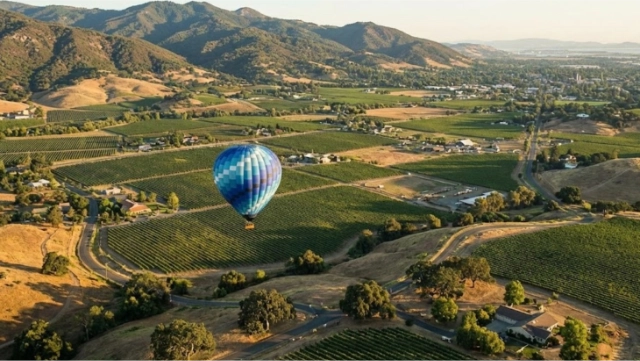
Drains 166 square miles of Sonoma Valley.
Human Presence
~70,000 residents
Flora
Oak savanna, riparian corridors, tidal wetlands.
Fauna
Steelhead, beaver, waterfowl, songbirds.
History & Restoration
The Sears Point Restoration returns former hay fields to tidal marsh, while Beaver Dam Analogs restore upstream hydrology.
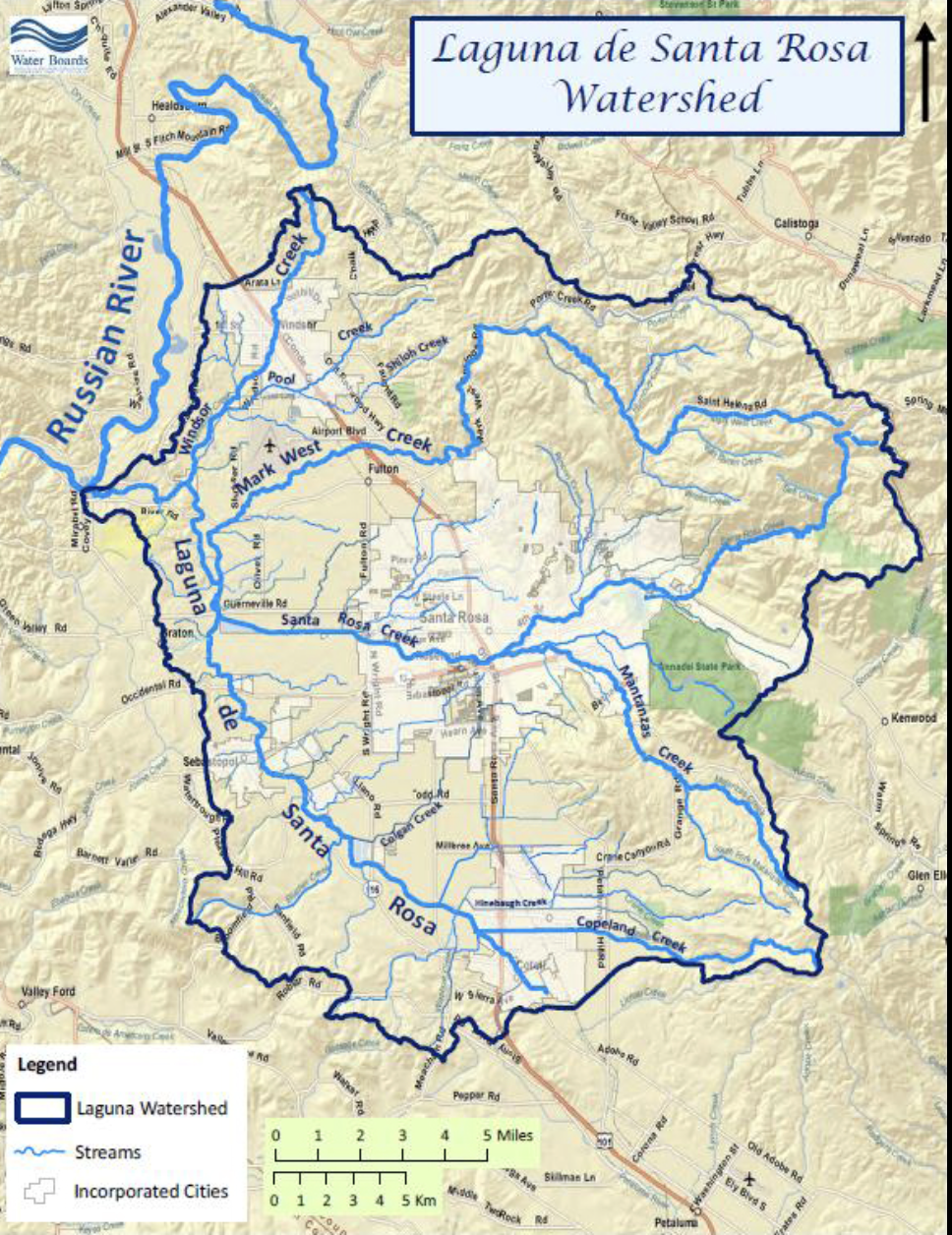
The System
Sonoma County’s largest tributary to the Russian River.
Human Presence
~100,000 residents in the basin
Flora
Seasonal wetlands, oak woodland, riparian forest.
Fauna
Native fish, amphibians, migratory birds.
History & Restoration
Tributaries like Santa Rosa Creek were channelized and undergrounded to reclaim floodplain land. Restoration now focuses on invasive removal and wetland function recovery.
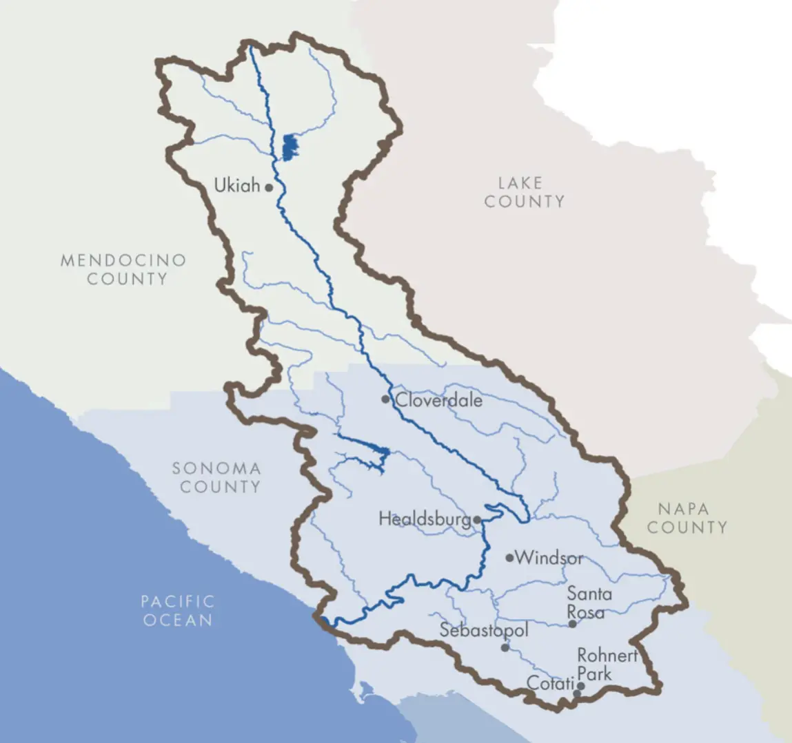
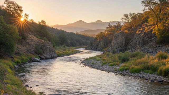
The System
The North Bay’s hydrologic giant (1,485 square miles), beginning in Mendocino County and flowing to the Pacific.
Human Presence
~250,000 residents
Flora
Redwood forest, oak woodland, floodplains, estuary.
Fauna
Coho salmon, steelhead, mountain lions, black bears (upper watershed), diverse birdlife.
History & Restoration
Named for Russian fur traders protected by Fort Ross. Major reservoirs—Lake Mendocino and Lake Sonoma—support communities while requiring intensive restoration downstream.
Watersheds remember what we forget. Restoration begins with the acts of listening and learning.